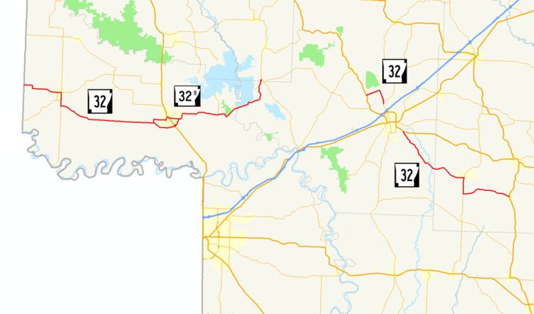
Arkansas Highway 34 (AR 34) is a designation for two state highways in the Upper Arkansas Delta. One segment of 27.22 miles (43.81 km) runs from US 412B in Walnut Ridge east to Highway 135 in Oak Grove Heights. A second segment of 12.96 miles (20.86 km) runs from Highway 135 in Lafe east to Highway 139 at Fritz. Both routes are maintained by the Arkansas State Highway and Transportation Department (AHTD).
Route description
Walnut Ridge to Oak Grove Heights
Highway 34 begins at US 67B/US 412B and Highway 367 in Walnut Ridge and runs northeast under US 67, before meeting Highway 231 at Giles. The route meets Highway 90 in O'Kean, and runs concurrently with it northeast to Delaplaine. Highway 34 turns south in Delaplaine to Evening Star, when it heads east to meet Highway 141 in Beech Grove. The route continues east to Oak Grove Heights, where it terminates at Highway 135.
Lafe to Fritz
The route begins at Highway 135 in Lafe and runs east to Marmaduke, where it crosses US 49. Highway 34 continues east to Fritz, where it terminates at Highway 139.
Major intersections
Mile markers reset at concurrencies.
See also
- List of state highways in Arkansas
References
External links
Media related to Arkansas Highway 34 at Wikimedia Commons